
Georeferencing: Two Points
To access this function:
-
Activate the Georeference ribbon and select Two Points.
Note: Georeferencing isn't relevant to level or wireframe maps, which always have a world coordinate context.
Studio Mapper presents a collection of map data objects, known as a "Map". A map can contain a variety of artefacts including a drive profile, image, contact and polygon strings, structures and so on. A map can represent a single face or a full or partial drive. This can be determined interactively as well as being predefined with Studio Mapper's System Configuration File.
Initially, a map is generated without any reference to its position in world coordinates. This "local map" is displayed using a dedicated map window that would generally be used in a 2D sense to digitize geological features and otherwise embellish the map with useful information. Studio Mapper presents this information using a dedicated "Map view". The Map view can be used both before and after georeferencing to manage the contents of a map with regards to features, comments, sketches etc.
A map is georeferenced to position it in the 3D world space.
The "Two Points" method uses two defined points to orient a map along a 3D axis in world space. By default, the map is aligned vertically, but can be rotated around its axis using the Rotate tool afterwards.
To georeference a map using two digitized points:
- Display, load or create a map and display it using a map window.
- Activate the Georeference
ribbon and select Two Points,
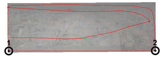
using left or right-click (snapping), for example:
-
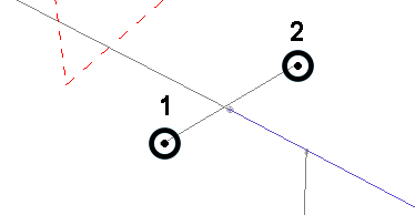
Activate the 3D World window and select two points in 3D space, like this:
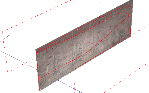
The map is oriented vertically, aligning point 1 on the map and the 3D world view, orienting the azimuth of the map so it aligns with the axis defined by point 2. Note that the map dimensions are unaffected. In other words, there is no scaling performed, for example:
Related topics and activities